Chapter 17 Hawaii
Hawaii and the San Fernando Valley are two completely different worlds. They have almost nothing in common besides the fact that they are tourist locations because they have special characteristics that cannot be found anywhere else. Hawaii is one of the most exotic places you can visit with the weather, culture and broad range of activities and The Valley is a popular place for tourism because of it's popularity in the film industry and the proximity to Hollywood. Another similarity between the two regions is that they both sit on land that is at the mercy of mother nature. Hawaii is a region of several islands formed by underwater volcanoes that have erupted over thousands of years and created islands, and the San Fernando Valley is located on Earthquake plates and we can experience an earthquake at any given moment and it can destroy pretty much everything just how the 1994 earthquake devastated several thousands of people in Northridge and the greater Los Angeles area.
Chapter 16 Pacific Northwest
The Pacific Northwest and the San Fernando Valley do not share any climate characteristics, but do have some similarities. The "PNW" had a large Native American population which lived there in tribes long before it became part of the United States, and the San Fernando Valley was also inhabited by Native Americans for thousands of years before the Spanish and Mexicans and eventually Americans made it their land. Many tribes had lands in present day Calabasas as well as Encino, Tujunga, and Pacoima. Both regions had a heavy Native American inhabitancy before being developed into what they are known as today.
Chapter 15 California
Being that the San Fernando Valley is actually a part of California this portion of the blog will be used to explain the differences between So Cal and Nor Cal. One of the biggest differences is the climate, Southern California has a warmer, dryer climate with a lot less rain in comparison to the cooler, foggy climate of Northern California. Northern California is less crowded in a larger land area in comparison to Southern California and is a lot more congested (405 is the best example of this). Northern California has a great public transportation/transit system in comparison to the inadequate public transportation in So Cal. It is almost impossible to get around without a vehicle down here where as there are several transportation methods up north. This shows that although they are part of the same state, the north and south parts of the state are very diverse and almost completely different from each other. Some characteristics that they do share though are the high price of living, California is generally an expensive place to live in comparison with the average cost of living in the country. Both regions have a big city that is a large tourist attraction (San Francisco in the North and Los Angeles in the South.

 Here is a photo of the cable cars in San Francisco and the famous 405 traffic of Southern California to compare the methods of transportation between the two regions of California


Chapter 14 MexAmerica
MexAmerica is a southern region in the United States that is along the border of the US and Mexico. This region has a lot of Spanish/Mexican/Hispanic influence because of it's proximity to the border. This region has a high population of Mexicans compared with the rest of the country and a lot of cities has Spanish names that have stuck around even after they became US territories. Since the Valley is a part of California which used to be Mexican/Spanish territory, there is a lot of Mexican influence in the Valley. According to the US Census Bureau, the Valley has about 42% Hispanic/Latino population*. Not only is the influence in the demographics, but also in the architecture of homes and older buildings. There are thousands of "Spanish Style" homes throughout the valley and it is one of the most popular classic styles for building a house most recognizable by multiple arches along the front of a house and it is influenced by the Hispanic culture.
*http://factfinder2.census.gov/faces/tableservices/jsf/pages/productview.xhtml?pid=ACS_12_5YR_DP05&prodType=table
*http://factfinder2.census.gov/faces/tableservices/jsf/pages/productview.xhtml?pid=ACS_12_5YR_DP05&prodType=table
Chapter 13 Intermontane West
The Intermontane West is a land region sitting between 2 mountain ranges. This can make it a very similar to the San Fernando Valley. They are both lands located between multiple mountain ranges with a typically dry climate. Both areas experience extreme heat during summer (although the Valley won't reach temperatures as high as the Internmontane) and during most of the time the rest of the year with some rain and cold weather during winter but not nearly as much as other parts of the country. They are also similar in that they are both have the dry climate due to the heat, not too much humidity if any at all which makes the heat unbearable at times when it jumps into the triple digits.
Chapter 12 The Rocky Mountains
The Rocky Mountains are one of the most famous land features of North America. Known for their vast size, amazing scenery and breathtaking views it is one place I would love to be able to see at one point in my life. Since it is a Valley, clearly there won't be any scenic mountains running through the Valley, but the surrounding mountains can be used to view the valley. People will go to the Rocky Mountains for breathtaking views of nature, and you can go to the hills up in Encino/Tarzana/Sherman Oaks and find some beautiful views of the Valley especially at night with all the city lights on. The Rocky Mountains usually are covered in a lot of snow and that is something you cannot expect out of the desert climate in the Valley, but a 1 hour drive east into the San Bernardino Mountains to Big Bear/Lake Arrowhead will give you a similar feeling. Being in the mountains with the fresh unpolluted air along with soft white snow is very refreshing and only an hour away from the Valley making it a very easy destination for a quick getaway or vacation.


Chapter 11 The Great Plains
The Great Plains are a very much what they're name says. It is a very large area of flat land used mostly for agriculture which is the main use of this land. Although the San Fernando Valley is not the greatest area for agriculture, there are nearby areas such as Oxnard that are involved heavily in farming, but San Fernando Valley can relate to the Great Plains in other ways. There are several other characteristics about the region that can be similar as the Valley. The Great Plains has a severe weather unpredictability aspect. The weather can change very quickly within less than an hour. The San Fernando Valley is similar but not identical to this. In The Great Plains it is a much faster change in weather, but in the Valley the weather will also change from day to day. It can be extremely hot and sunny for weeks at a time, and out of nowhere we will get a few days of rain, a few days of unexpected wind, and then back to the sun and heat. The rain and wind can strike at the most unexpected times.
Chapter 10 Coastal South
The Coastal South chapter talks mostly about the agriculture industry as well as ports that have created great tourism conveniences. The San Fernando Valley does not have a rich agriculture and there is almost no farm lands in the area. There are a few exceptions though, such as the orange grove on the south east corner of CSUN campus. There is a good amount of tourism available in the San Fernando Valley like Universal Studios, where dozens of movies have been filmed and the film sets are usually kept for tourism purposes. Another special place is found between the Valley and Los Angeles, right off the 405. The Jean Paul Getty Museum which attracts over 1 million visitors annually is a special place with a lot of art as well as scenic views from the top of a mountain that overlooks almost all of Los Angeles.
This is a photo from Universal Studios showing a tour of the back lots and this section is from War of the Worlds and has been kept like this for tour purposes.
 An aerial view of the Getty Museum, showing not only how large it really is but also since it is sitting on top of a mountain, you can get almost 360 degree views of the city.

This is a photo from Universal Studios showing a tour of the back lots and this section is from War of the Worlds and has been kept like this for tour purposes.


Chapter 9 Inland South
Chapter 9 spoke about the Inland south and slavery as well as the growth of the cotton industry. California was never really a pro slavery state. When Mexico received its independence from Spain, the president abolished slavery. When US took over the land in 1847, many slave owners were trying to move west to California during the gold rush period and they were bringing slaves along with them. Although slavery was abolished in California, some slaves were still not freed because their owners would not tell them they were free and they would continue to be used as slaves. Slavery was completely abolished in 1865 along with all the other states.
Chapter 8 Great Lakes & Corn Belt
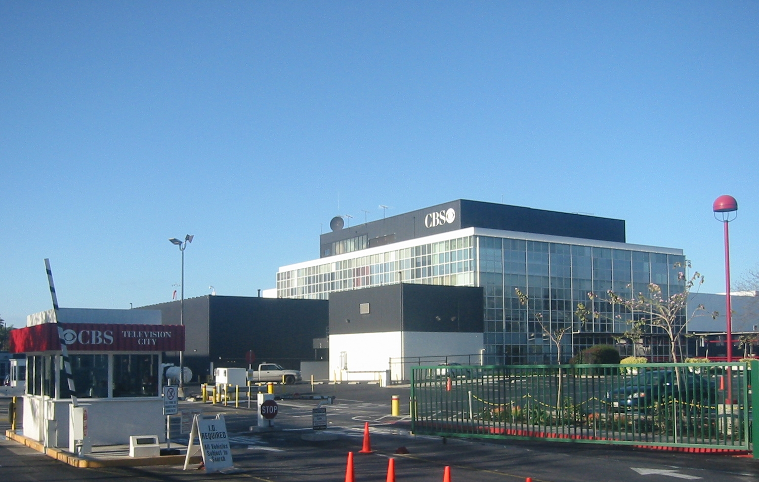
The Great Lakes and Corn Belt region of the United States thrives off the Primary and Secondary sectors with a lot of farming. The San Fernando Valley is not known as a prestigious farmland and their economy is driven with different businesses. There are many television studios in the valley including CBS, NBC, and Disney. There is also plenty of aerospace technology that contributes to the economy of the valley. The San Fernando Valley is also known as the Adult Entertainment Capital of the world with about 90% of all adult films being filmed by studios that are based out of the San Fernando Valley.


Chapter 7 Megalopolis
The textbook speaks of the Megalopolis on the east coast stretching through multiple states and becoming something like a Mega city. Although San Fernando Valley is a part of Los Angeles, it can be considered something like a mini megalopolis between Los Angeles and San Diego. Even though the Valley is part of LA county, it seems like it is its own city that has almost nothing in common with other parts of Los Angeles, but the 405 that connects the Valley to other parts of LA. such as Hollywood, Santa Monica, and Beverly Hills.


 Some photos of other parts of the LA area that are nearby the San Fernando Valley along with a picture of the traffic you can expect to be caught in on a daily basis when using the 405 to get to other parts of the city.


Chapter 5 Atlantic Periphery
The Atlantic Periphery and the San Fernando Valley will probably share almost nothing in common besides the fact that they are both in close proximity to the coast but on different sides of the country. The Valley does have numerous mountain ranges on all sides which are the Santa Susana mountains on the north end, the Santa Monica ranges on the south end, The Verdugo and San Gabriel Mountains on the eastern side, and the Simi Hills to the west. These mountain ranges all have scenic routes and trails for hikers and bikers who like to enjoy the outdoors. The Los Angeles River also flows through the valley starting on the western side near Calabasas and flows east along the southern portion of the valley.
Chapter 4 Political Economy
There are 5 separate incorporated cities in the valley, Glendale, Burbank, Calabasas, Hidden Hills, and San Fernando but the entire valley is governed under the County of Los Angeles. The Valley is represented in the State Legislature, State Assembly, and State Senate. Brad Sherman is a representative for the Valley in Congress. The current mayor of the city is Eric Garcetti who has been in office since 2013.
Chapter 3 Historical Settlement
There have been many Native American tribes that have settled and lived in the valley dating back almost 8,000 years. They thrived off hunting camps and trading and called the land their home until the Spanish came to begin settlement there in 1769. Mission San Fernando Rey de Espana was built in present day Mission Hills in 1797. (I have actually made a visit to this mission about 13 years ago). Urbanization into the valley during the 20th century began in the late 50s thanks to three new industries, the film industry, automobile industry, and the airplane industry. (There are multiple aviation business located throughout the valley including a Boeing Laboratory.) The plans of 1960s to develop an area known as "Porter Ranch" ended up expanding the original size of the valley by about 50 square miles.
An old photograph of the San Fernando Mission which has now been converted into a museum.

An old photograph of the San Fernando Mission which has now been converted into a museum.

Chapter 2 Environmental Setting
The San Fernando Valley is located slightly north of Los Angeles but is
still a part of the county. It is elevated at between 600 and 1,200 feet
above sea level. There is also the Los Angeles River that flows through
the valley. The valley covers an area of about 260 square miles. The
climate is usually referred to as desert, but this is incorrect. The
climate is actually temperate grasslands, savannas, and shrub lands
originally. The Northern end of the valley, specifically Porter Ranch and Granada Hills region have brush fire season every year right before the start of winter due to hot weather and no precipitation. The Valley goes through frequent droughts and is currently
experiencing one at the moment. According to a study by the Woodland
Hills patch, 2013 was the driest year on record (since 1877 when records
started) with a whopping 2.5 inches of rain.(http://woodlandhills.patch.com/groups/around-town/p/2013-may-be-driest-on-record-for-woodland-hills) Average temperatures range between the 40s-60s during winter months, and 60s to high 80s in the summertime.
This map shows the boundaries of the valley and the surrounding areas.

 An aerial shot of the smoke clouds caused by brush fires in Porter Ranch.
This map shows the boundaries of the valley and the surrounding areas.


Chapter 1
Chapter 1 is the introduction to the United States geography for this semester. My first blog will be an introduction about the San Fernando Valley. It is geographically located slightly north of Los Angeles and mostly falls under LA county. Surrounded by several mountain ranges on each side of its valley including the Santa Susana Mountains, Santa Monica Mountains, Santa Ana Mountains, and a few more in the area. It is home to a population of almost 2 million residents.
Below is a video made by the Los Angeles times about the San Fernando Valley and what it has to offer including Universal Studios, and other attractions that people can look at while visiting the valley.
Below is a video made by the Los Angeles times about the San Fernando Valley and what it has to offer including Universal Studios, and other attractions that people can look at while visiting the valley.
Subscribe to:
Comments (Atom)